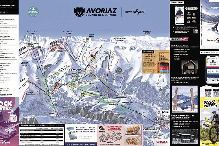
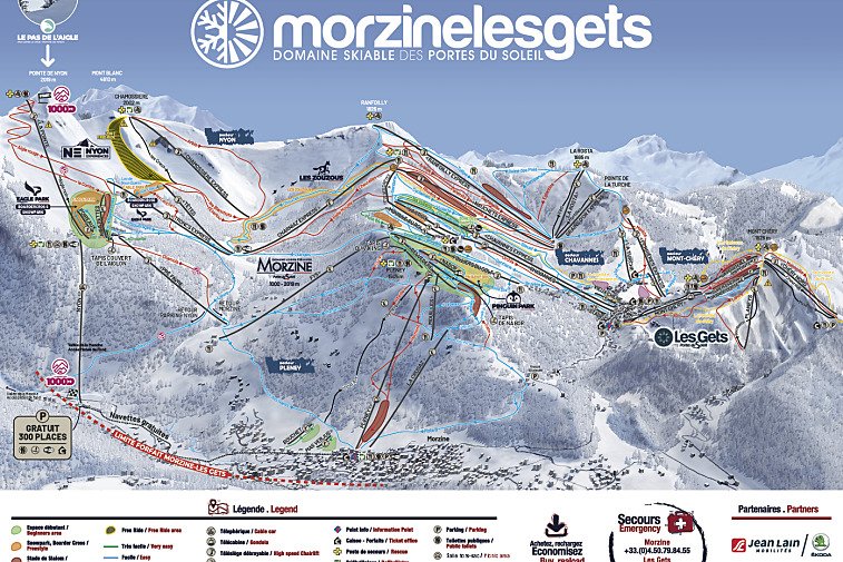
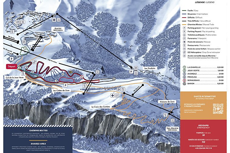
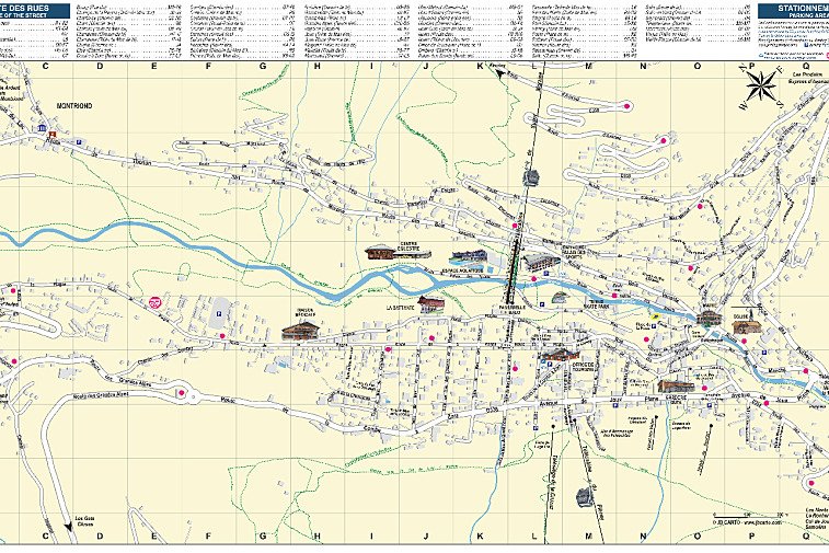
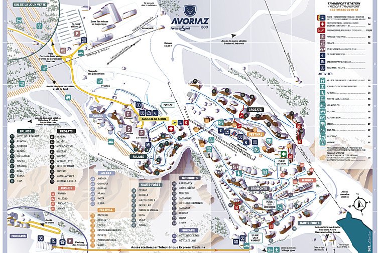
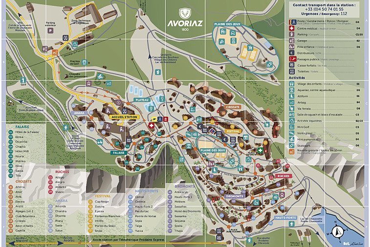
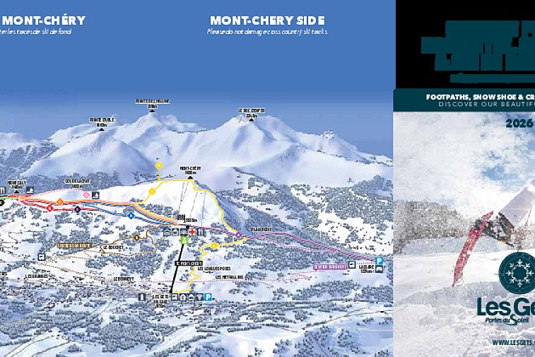
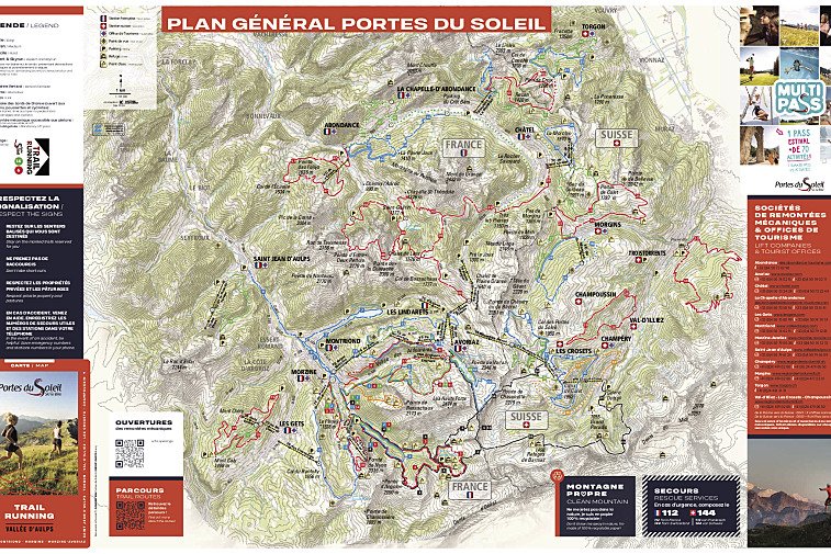
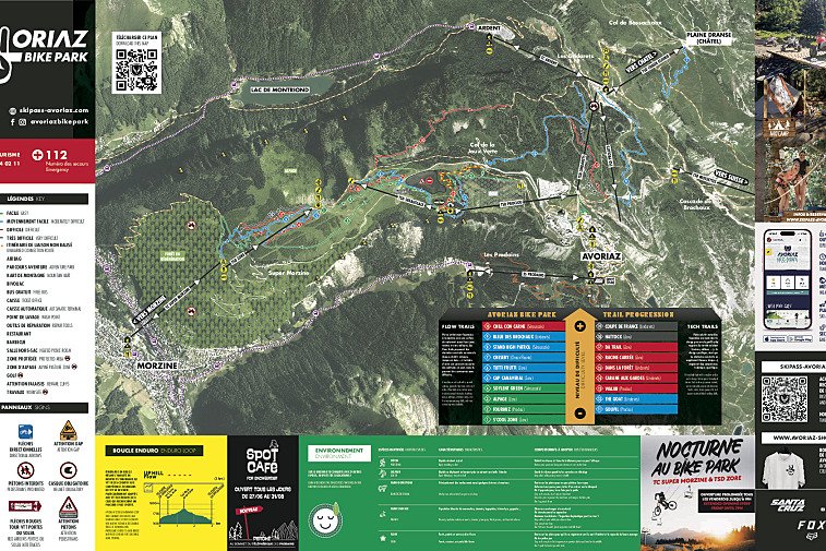
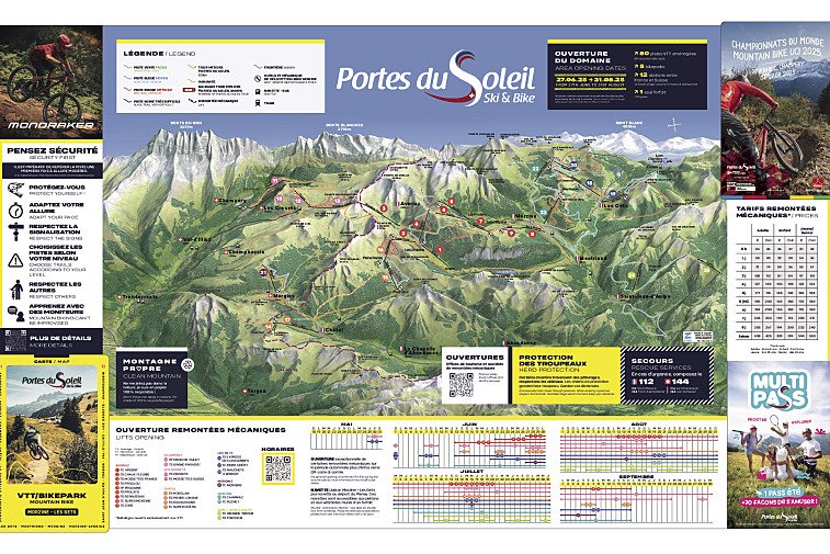
© SeeAvoriaz.com
Maps of Avoriaz
Download the essential Avoriaz maps & plans
We hope this selection of piste and lift maps, street maps, and activity area maps for Avoriaz will help you find your way around so you can make the most of this great part of the world.
Situated about an hour and a half from Geneva, Avoriaz and Morzine are the main resorts of the Portes du Soleil area, famous for its mountain sports in both summer and winter. Avoriaz is perched on a dramatic cliff top and enjoys wonderful views of the mountains and down to Morzine in the valley below.
Piste maps
The lifts are marked on the piste maps using straight black lines and there are four types; button tow/drag, chair, télécabine and télépherique. They have the corresponding abbreviations:
- TK - téléski (drag)
- TS - télésiege (chair)
- TC - télécabine (gondola)
- TPH - téléphérique (cable car)
Anything prefixed/suffixed with “Express” means a six-person fast chairlift.
Town maps
Avoriaz Town Maps |
---|
Avoriaz Town Map |
Morzine Town Map |
Les Gets Town Map - Summer |
Winter walking / trail maps
Avoriaz Winter Walking Maps |
---|
Avoriaz Winter Walking Map |
Les Gets Winter Walking Map |
Portes du Soleil Winter Walking Map |
Cross-country skiing maps
Avoriaz Cross-Country Skiing Maps |
---|
Avoriaz Cross-Country Skiing Map |
Les Gets Cross-Country Skiing Map |
Hiking & walking maps
Avoriaz Hiking & Trail Running Maps |
---|
Avoriaz Hiking Trail Map |
Les Gets Hiking Trail Map |
Trail Running Maps |
Mountain bike trail maps
Avoriaz Mountain Bike Trail Maps |
---|
Avoriaz Mountain Bike Trail Map |
Portes du Soleil Bike Trail Map |
Portes du Soleil Electric MTB Trail Map |
Morzine - Les Gets Bike Trail Map |